
Selling Land in Chalkidiki – Plots, Buildability and Buyers
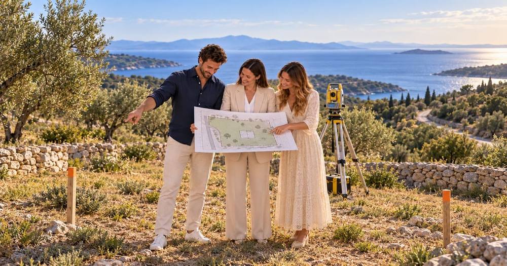
A house is sold on lifestyle and condition. A plot is sold on one question: what may lawfully be built on it? Everything else — the view, the olive trees, the proximity to the sea — matters only once that question has an answer, and a plot whose answer is unclear is very difficult to sell at any price.
That makes selling land in Chalkidiki a technical exercise before it is a commercial one. The seller who can produce a current topographic plan, a clear statement of the planning regime, confirmation of road frontage and access, and evidence on forestry, coastal and archaeological restrictions is selling a defined product. The seller who offers “four thousand square metres near the sea” without documents is asking a buyer to price an unknown, and buyers price unknowns harshly.
This guide covers the whole picture: buildability and how it is calculated, the restrictions specific to this coastline, the documents a plot sale requires, how land is valued, who the buyers are, how to market a plot, and the particular routes available to owners of larger or well-positioned parcels — including sale to developers and the traditional land-for-property exchange.
Chalkidiki Real Estate sells plots across all three peninsulas and the surrounding mainland, and coordinates the surveyor, engineer and lawyer whose work makes a plot sellable. Technical and legal opinions remain the responsibility of those professionals.
Planning rules, forest maps and coastal delimitation change and are parcel-specific. This page is a planning guide, not a statement about your land.

Do you own a plot or a piece of land in Chalkidiki and want to know what may be built on it and what it is worth? Contact me by phone, WhatsApp or email.
- Mobile: +30 693 470 9163
- WhatsApp: +30 693 470 9163
- Email: hb@chalkidikirealestate.com
- Location: Chalkidiki Real Estate
- LinkedIn: Hans-Jürgen Bahner – Over 17k Followers
- Bestselling Author: Find My Books Here
We sell plots across Kassandra, Sithonia, Athos and the mainland — including the surveying and buildability work that makes land sellable.
On this page
Select a topic to see what makes a Chalkidiki plot sellable, and at what price.
Why Land Is a Different Product
Selling a house means selling something a buyer can walk through and evaluate emotionally. Selling a plot means selling a calculation, and the buyer cannot make it without documents.
The consequences run through the whole process. The buyer pool is smaller and more technical. The questions come earlier and are harder. The buyer’s engineer is involved before the buyer’s lawyer, and often before the first viewing. Photographs matter less than a topographic plan. And the marketing period is generally longer, because the number of people who want a specific plot at a specific price is far smaller than the number who want a house.
Value is also concentrated in a single variable. Two adjoining parcels of identical size can differ in value by a multiple, because one lies inside a settlement boundary with a generous building coefficient and the other lies outside it with a minimum plot requirement it does not meet.
The seller’s task, therefore, is not to describe the land attractively. It is to establish, with documents, exactly what a buyer may do with it — and then to price that.
Who Buys Land in Chalkidiki
Individual buyers building a home. Usually foreign, frequently German-speaking, wanting a buildable plot close to the sea on which to build a holiday or retirement house. They need reassurance about buildability, access, utilities and the process of building in Greece, and they are the largest group for plots up to around a thousand square metres inside settlements.
Small developers and builders. Local and regional, buying plots on which to build one or several units for sale. They price precisely on buildable square metres and construction cost, they move quickly when the numbers work, and they will not pay a premium for a view that does not translate into sale value.
Investors holding land. Buying larger parcels near expanding settlements, or agricultural land with a long-term expectation. Price-sensitive, patient, and interested in the planning trajectory of the area.
Neighbours. Consistently underestimated. The adjoining owner who wants to enlarge their plot, secure their view, or obtain road frontage is frequently the best buyer available, and often the only one who will pay a strategic premium.
A plot that suits several of these is liquid. One that suits only investors — a large agricultural parcel without buildability — needs a longer horizon and a price to match.
Buildability: the Central Question
Whether and how much may be built on a plot depends on a set of parameters that only an engineer can apply reliably to a specific parcel: whether it lies inside or outside a settlement boundary or a town plan, the applicable building coefficient, the coverage ratio, permitted number of storeys and height, required setbacks, minimum plot size and frontage requirements, and any special regime affecting the area.
Sellers frequently quote a figure they were told years ago, or that applies to a neighbouring plot. Both are unreliable: rules change, settlement boundaries are redrawn, and neighbouring parcels can fall under different regimes.
What a serious buyer wants is a statement from a licensed engineer, based on a current topographic plan, of what may be built — built area, coverage, storeys, height, position of the building envelope. Obtaining that costs a professional fee and it is the single most effective investment a land seller can make, because it converts an argument into a fact.
Where the answer is unfavourable — a plot outside a settlement that does not meet the minimum size or frontage requirement — it is better to know it and price accordingly than to discover it when a buyer’s engineer reports it.
Inside and Outside Settlement Boundaries
This is the fundamental distinction in Greek land, and it produces most of the price difference between apparently similar parcels.
Inside a settlement boundary or an approved town plan, plots are generally buildable subject to the local parameters, minimum sizes are smaller, infrastructure is usually present or nearby, and the permitting path is more predictable. These are the plots individual buyers want.
Outside the boundary, the regime is considerably more restrictive. Minimum plot sizes are large, frontage onto a recognised public road is required, and construction is permitted under a framework of general rules and exceptions, several of which depend on the history of the parcel and on when it was formed. An engineer’s opinion is essential, because two parcels of the same size outside a settlement can have entirely different rights depending on their history.
Boundaries also move. Settlement boundaries have been redrawn and, in some cases, judicially challenged, which can change a parcel’s status. A statement obtained ten years ago is not evidence of the current position.
Establish the position for your parcel before pricing it. It is the difference between a plot for a family building a house and a plot for a patient investor.
Minimum Plot Size, Frontage and Access
Greek planning requires a plot to satisfy conditions of size and shape before it may be built on, and outside settlements it must also have legal access onto a recognised public road.
Access is where Chalkidiki plots most often fail. A track that everyone has used for forty years is not necessarily a public road, and a plot reached across a neighbour’s land without a registered right of way is, from a buyer’s point of view, a plot that may never be built on. Where access exists only by agreement, the agreement should be formalised and registered before a sale.
Frontage requirements matter equally: a large parcel with a narrow strip touching the road may not qualify, and an otherwise excellent plot can fail on geometry alone.
These questions are answered by a surveyor and an engineer working from the topographic plan and the cadastral record. They are also the questions a buyer’s engineer will ask first, so it is far better for the seller to have the answers than to hope they do not come up.
Where access can be improved — by formalising a right of way, or by agreement with a neighbour — doing so before marketing can change the plot’s value materially.
Coefficients, Coverage and Storeys
The building coefficient determines how much floor area may be built relative to the plot area; the coverage ratio determines how much of the plot the building may occupy at ground level; and the permitted storeys and height determine how that area may be distributed.
Together they define the envelope, and for a developer they define the entire economics of the purchase. A plot that permits three hundred square metres of built area is worth substantially more than an identical plot permitting one hundred and fifty, whatever the view.
Setbacks from boundaries, from the road and from any protected feature reduce the usable footprint further, and on a narrow or irregular plot they can make a theoretically buildable area impossible to realise in practice. This is why a competent engineer produces a sketch of the building envelope rather than only a number.
For marketing purposes, express it in terms a buyer understands: what could actually be built here — a two-storey house of a given size with a pool and parking, or three apartments — rather than a coefficient alone. Buyers, including experienced ones, respond to the concrete outcome.
The Topographic Plan
A current topographic plan, signed by a licensed surveyor or civil engineer and prepared in the national coordinate system, is not optional for a plot sale. It is the document from which everything else is derived.
It establishes the measured area — which frequently differs from the deed, sometimes substantially, on parcels described in older titles by reference to neighbours rather than by measurement. It fixes the boundaries and shows the frontage. It positions the parcel relative to the settlement boundary, the road, and any watercourse or feature. And it can be reconciled with the cadastral record, which is what the buyer’s lawyer will do.
Older plans often need to be redrawn to current standards and coordinates. Budget one to three weeks, and longer in the summer when surveyors in Chalkidiki are heavily booked.
A plot offered without a current plan attracts fewer enquiries, more sceptical buyers and lower offers, and in practice cannot be sold to an international buyer at all. It is the first thing to commission, before the property is priced.
Cadastre, Boundaries and Neighbours
The cadastral record shows the parcel’s registered geometry and the rights over it, and errors from the cadastral transition are common in Chalkidiki, particularly on rural land.
Typical findings: a registered area that differs from the survey; boundaries that do not match the fences and walls on the ground; overlapping registrations where two neighbours each declared the same strip; a parcel registered to a deceased or previous owner; a parcel registered as belonging to the State or to an unknown owner; and parcels declared twice or not at all.
Each has a remedy, and each takes time — weeks for a straightforward correction, months where a neighbour disputes a boundary or where the State is the registered owner.
Because land disputes with neighbours are slow and expensive, it is worth resolving boundary questions before marketing, ideally by agreement documented between the parties and reflected in the cadastre. A buyer who discovers an unresolved boundary issue during due diligence will either withdraw or discount heavily, and their discount will exceed the cost of settling it.
Forest Maps and Forestry Classification
Greece has compiled and progressively ratified forest maps, and their effect on land in Chalkidiki is significant. Land characterised as forest or forest land is subject to protective legislation that severely restricts or prevents building, regardless of what the cadastre or the deed says.
Classification does not follow appearances. A parcel with olive trees and no forest character can be mapped as forest land because of what it looked like decades ago in the reference aerial photography, and a wooded parcel can be classified as agricultural.
There are procedures for objecting to a classification and for establishing that a parcel is agricultural, but they are technical, take time and are not always successful. For a seller, the essential step is to establish the current classification for the specific parcel through an engineer or forestry specialist, before pricing and before marketing.
A plot with a favourable classification and documentary evidence of it sells at a clear premium over a comparable plot whose status is uncertain, because the buyer is not being asked to carry the risk.
The Coastal Zone and Setback Line
Land near the sea is subject to the delimitation of the foreshore and beach zone, which is public property, together with a further protective strip. Construction within these areas is prohibited or tightly controlled, and rights of public access must be respected.
For a plot near the water, three things need to be established: whether the coastal delimitation has been carried out and ratified for that stretch, where the line falls in relation to the parcel, and how much of the parcel is consequently unbuildable.
This can be decisive. A first-line plot whose buildable area is reduced by the setback may be worth less than a second-line plot with a full envelope, despite the better position — and the buyer’s engineer will calculate exactly that.
Where the delimitation has not been carried out, the uncertainty itself depresses value, because a buyer cannot know what they may build. Sellers of coastal land should obtain the position in writing from a competent professional and present it, rather than allowing every buyer to assume the worst.
Archaeological and Protection Zones
Chalkidiki has a long settlement history and a number of archaeological sites and zones, alongside environmental protection designations, Natura areas and traditional-settlement rules in some villages.
The effects range from a requirement for archaeological supervision during excavation, which adds cost and time to a build, through height and design restrictions, to an outright prohibition on construction in the most sensitive zones.
These designations are parcel-specific and are established through the competent authorities, usually by the engineer during the preparation of the file. They are not a reason not to sell, but they must be disclosed, because they will be discovered: a buyer intending to build will consult the same authorities before applying for a permit.
Where restrictions exist, the marketing should present them together with what remains possible. A plot with a design restriction in a traditional settlement is still a good plot for the buyer who wants a house in that settlement; a plot presented as unrestricted and later found to be restricted is a failed transaction.
Your local contact in Chalkidiki
Get in Touch with Hans-Jürgen Bahner
Do you own a plot or a piece of land in Chalkidiki and want to know what may be built on it and what it is worth? Contact me by phone, WhatsApp or email.
- Mobile: +30 693 470 9163
- WhatsApp: +30 693 470 9163
- Email: hb@chalkidikirealestate.com
- Location: Chalkidiki Real Estate
- LinkedIn: Hans-Jürgen Bahner – Over 17k Followers
- Bestselling Author: Find My Books Here
We sell plots across Kassandra, Sithonia, Athos and the mainland — including the surveying and buildability work that makes land sellable.
Agricultural Land and Its Limits
Much of the land held by families in Chalkidiki is agricultural: olive groves, fields, parcels inherited from grandparents. It is worth being realistic about what it is worth and to whom.
Agricultural land without buildability trades at a small fraction of the price of a building plot, and the buyer pool is local farmers, neighbours and patient investors rather than the international market. Parcels of high agricultural productivity may also be subject to specific protective rules restricting change of use.
What can change the picture: proximity to an expanding settlement boundary, frontage onto a public road, sufficient size to qualify for construction under the rules applying outside settlements, or an adjoining owner who needs the parcel. Any of these can turn an ordinary field into something considerably more valuable, and each is worth establishing before assuming the land is worth little.
What does not change the picture is a sea view. A beautiful, unbuildable parcel is an unbuildable parcel, and international buyers who fall in love with the position withdraw as soon as their engineer reports.
Sell agricultural land honestly, to the buyers who want it, at a price that reflects what it is. Marketing it as a building opportunity wastes everyone’s time and damages credibility.
Water, Electricity and Access Roads
A buyer intending to build asks three practical questions immediately: can I connect to electricity, can I get water, and can a concrete truck reach the plot?
Electricity connection depends on the distance to the nearest network and on whether the plot is in an area served; connections over long distances are expensive and the cost falls on the buyer, which they will deduct from their offer. Water may come from a municipal network, from a community supply or from a borehole, each with different implications for cost, quality and permitting. Drainage will usually mean a septic system where there is no sewer, which affects the plot layout.
Access must be adequate not only in law but in practice: a track that a car can manage in August may not carry construction traffic in February.
Sellers who obtain the answers — distance to the network, the water situation, the condition and status of the access — remove three objections at a stroke. Where the answers are unfavourable, they are still better disclosed and priced than discovered. Our utility registration service deals with these connections routinely.
How Land Is Valued
Land valuation follows the buildable envelope more than the area. The practical method is to establish what may be built, compare with recent transactions of parcels with similar rights in similar positions, and adjust.
The factors that move value most in Chalkidiki: whether the parcel is inside a settlement boundary; the buildable area in square metres; distance and access to the sea; whether any sea view is secure or could be built out; road frontage and the quality of access; utility availability; the shape and slope of the parcel, since an awkward or steep plot costs more to build on; forestry, coastal and archaeological status; and the cleanliness of the title and cadastral position.
A useful cross-check for a buildable plot is the developer’s calculation: what could be built, what it would cost to build, what the finished product would sell for, and therefore what the land can be worth. Where a seller’s asking price exceeds what that arithmetic supports, developers will not bid and the plot depends entirely on an individual buyer.
The general valuation method, including the objective value and the warning signs of an inflated figure, is on property valuation in Chalkidiki.
Objective Value for Land
Land has an administrative value like any other property, calculated from official data and used for transfer taxation, for ENFIA and for inheritance and gift tax. It is not a market valuation and, for land in particular, it can diverge sharply from what a buyer will pay.
Two situations arise regularly. On the coast, the objective value of a buildable plot is often well below the market price, which is favourable for the buyer’s transaction costs. Inland and for agricultural parcels, the objective value can exceed what anyone will actually pay — with the result that the buyer is taxed on money they are not spending, which suppresses demand and must be reflected in the asking price.
The declared price in the deed cannot be lower than the objective value, so a plot whose market price is genuinely below its administrative value presents a real problem that both parties must understand before terms are agreed.
Have the objective value calculated by an accountant or notary at the start. For land it is more likely to matter than it is for a house.
The Document File for a Plot
| Document | Purpose |
|---|---|
| Title deed and registration evidence | Ownership and chain of title |
| Cadastral extract and diagram | Registered geometry and rights |
| Current topographic plan | Measured area, boundaries, frontage, position |
| Engineer’s buildability statement | What may be built, and where on the plot |
| Forestry position / forest map extract | Whether the parcel is characterised as forest land |
| Coastal delimitation position | Setback line and unbuildable area, for coastal plots |
| Archaeological / protection zone confirmation | Restrictions on construction and design |
| Evidence of legal access | Public road frontage or registered right of way |
| Utility position | Distance to electricity, water source, drainage |
| ENFIA certificate and municipal clearance | Tax and municipal position |
| Seller identification and AFM | Identity and tax number |
Where the land was inherited, add the acceptance of inheritance and its registration — see selling inherited property in Greece. The general checklist is on documents required to sell property in Greece.
Border Areas and Foreign Buyers
Greece designates certain regions as border areas, where acquisitions by nationals of countries outside the EU and EFTA require an administrative approval procedure. The obligation falls on the buyer, but it affects the seller directly by narrowing the buyer pool and adding time to any transaction with an affected purchaser.
If your land lies in such an area, establish it at the outset with a lawyer. It is not an obstacle to a sale, but it changes who the realistic buyers are and how long a transaction will take, and both belong in the pricing and the marketing plan rather than in a late surprise.
The same logic applies to any other status that limits who may buy or what they may do: forestry classification, coastal restrictions, protection zones. A plot marketed with its restrictions clearly stated reaches the buyers who can actually complete; a plot marketed without them reaches everyone and converts nobody.
Buyers researching the other side of this question will find it on buying land and building plots in Greece.
Marketing a Plot
A plot is marketed with documents and imagery that establish position and possibility, rather than with interior photographs.
What works: an aerial image showing the parcel with its boundaries marked, in the context of the settlement and the coastline; the topographic plan; a sketch of the building envelope showing what could be built; ground-level photographs from several points including the view; a short video walking the boundaries; and a clear statement of area, buildable area, frontage, access, utilities and status.
The description should answer the developer’s and the self-builder’s questions directly: how many square metres may be built, over how many storeys, what the setbacks are, how far to the sea in walking minutes, how far to the nearest village and to the airport, what the access road is like in winter, where the electricity is, and what the water situation is.
Do not market a plot before the topographic plan and the buildability statement exist. Land enquiries convert into questions immediately, and a seller who cannot answer them within a day loses the buyer to a plot that can.
Direct outreach matters more for land than for houses — to registered buyers looking for plots, to local developers, and to the neighbours. The wider marketing framework is on property marketing for international buyers.
Selling to Developers and Land-for-Property Exchange
For a well-positioned plot with meaningful buildability, a developer may be the best buyer — or the counterparty in a different kind of transaction altogether.
A straightforward sale to a developer is fast and clean when the arithmetic works. Developers pay what the finished product supports, they complete without financing conditions if they are established, and they do not need to fall in love with the view. They also negotiate hard and will not pay a premium a private buyer might.
The traditional Greek alternative is antiparochi, the exchange of land for a share of the property to be built on it. The landowner contributes the plot and receives an agreed number of finished units instead of cash. It can produce a considerably better economic outcome than a cash sale, and it converts a single asset into several sellable ones.
It also carries real risk: the developer must complete, to a defined standard, on a defined timetable, and the contract must allocate that risk properly — security, staged obligations, penalties, and what happens on default. Antiparochi agreements are specialist notarial and legal work, and they are not a transaction to enter on trust. Take independent legal advice, and check the developer’s completed projects before signing anything.
Dividing a Plot Before Selling
Owners of larger parcels frequently ask whether to divide before selling. Sometimes the answer is yes and the uplift is substantial; often it is not.
Division is possible only where each resulting parcel independently satisfies the applicable requirements — minimum size, frontage, access — which outside settlement boundaries is a demanding test. Inside a settlement it is more often feasible.
Where it is feasible, the economics can be attractive: two or three plots in the size range individual buyers want are usually worth more in total than one large parcel, because the buyer pool for a small buildable plot is far larger than for a big one. Against that, division costs surveying, engineering and notarial fees, takes time, and may require infrastructure such as an access road.
The analysis is a straightforward comparison: the expected total value of the divided parcels less the cost and time of dividing, against the value of the parcel as it stands. An engineer and an agent can produce both figures.
One caution: do not begin a division on the assumption that it will be approved. Establish the position first.
Costs and Taxes on a Land Sale
The allocation is the same as for a house. The buyer pays the transfer tax of 3.09 per cent on the higher of the declared price and the objective value, the notary, the registration fees and their own lawyer. The seller pays the agency commission, the surveyor for the topographic plan, the engineer for the buildability statement and any forestry or coastal confirmations, the lawyer where instructed, and any outstanding ENFIA and municipal charges.
Land does not require an energy performance certificate or an electronic building identity, which removes two of the costs a house sale carries. In their place come the technical confirmations — topographic plan, buildability, forestry, coastal — which for a complicated parcel can amount to more.
The 15 per cent capital gains tax on individual transfers has been suspended repeatedly and the current suspension runs to the end of 2026; the position for your signing year should be confirmed, and the suspension does not apply to companies or to those trading in real estate professionally.
Where land is sold as part of a business activity, or with a building under construction on it, the tax analysis differs and should be checked in advance. Full detail is on costs and taxes when selling property in Greece.
Common Mistakes
- Marketing without a current topographic plan. The plot cannot be evaluated, and international buyers will not proceed.
- Quoting buildability from memory. Rules change and neighbouring plots differ; buyers verify with their own engineer.
- Ignoring the forest map. Classification does not follow appearances and can eliminate buildability entirely.
- Assuming access is legal because it has always been used. A track is not necessarily a public road.
- Leaving a boundary dispute unresolved. Buyers discount it far more heavily than it costs to settle.
- Pricing agricultural land as building land. The view does not create an envelope.
- Overlooking the objective value. For inland land it can exceed the market price and suppress demand.
- Forgetting the neighbours. Frequently the best buyer, and rarely approached.
- Entering an antiparochi agreement without independent legal advice. The risk sits with the landowner if the contract is weak.
- Starting a division without confirming it is permitted. Expensive and slow to unwind.
How Chalkidiki Real Estate Can Help
We sell plots across Kassandra, Sithonia, Athos and the mainland, and the work begins with establishing what the land actually is. We coordinate the surveyor for a current topographic plan and the engineer for a buildability statement, and we obtain the forestry, coastal and zoning position for the specific parcel, so that the plot is offered as a defined product rather than as an open question.
We then value it against comparable land transactions and against the developer’s arithmetic, and we market it with aerial imagery showing the boundaries in context, the plan, a sketch of what could be built, and a description that answers the technical questions buyers ask first.
Distribution combines our own site and portals with direct outreach — to registered buyers looking for plots, to developers we work with regularly, and, where it makes sense, to the adjoining owners, who are the most frequently overlooked buyers in the market.
Where a division, an antiparochi arrangement or a sale to a developer might produce a better outcome than a straight sale, we will say so and set out the comparison, together with the independent professionals you would need.
The initial assessment and the valuation are free and commit you to nothing.
Frequently Asked Questions About Selling Land in Chalkidiki
What is the first thing I should do?
How is a plot valued?
My land is outside the settlement boundary. Can it still be built on?
What does it mean if my land is on the forest map?
How does the coastal setback affect a seafront plot?
Is a plot with a sea view worth more?
Should I divide my plot before selling?
What is antiparochi and should I consider it?
Do I need an energy certificate to sell land?
Who is most likely to buy my plot?
Can a foreign buyer purchase land anywhere in Chalkidiki?
How long does it take to sell a plot?
Official Sources and Important Notice
Planning rules, settlement boundaries, forest maps and coastal delimitation are parcel-specific and change. Nothing on this page describes your land — obtain the position for the specific parcel from a licensed engineer, a surveyor and a lawyer before pricing or marketing it.
- gov.gr – Hellenic Cadastre, land registration and forest maps
- AADE – Independent Authority for Public Revenue
- gov.gr – Greek government digital services portal
Professional notice: This guide provides general information about selling land in Greece and is not engineering, planning, legal or tax advice. Buildability, forestry classification and coastal restrictions must be established for the individual parcel by qualified professionals.
Do you own a plot or a piece of land in Chalkidiki and want to know what may be built on it and what it is worth? Contact me by phone, WhatsApp or email.
- Mobile: +30 693 470 9163
- WhatsApp: +30 693 470 9163
- Email: hb@chalkidikirealestate.com
- Location: Chalkidiki Real Estate
- LinkedIn: Hans-Jürgen Bahner – Over 17k Followers
- Bestselling Author: Find My Books Here
We sell plots across Kassandra, Sithonia, Athos and the mainland — including the surveying and buildability work that makes land sellable.
Continue the Sell With Us Cluster
Land has its own technical file, but the sale itself follows the same route. Continue with the guides below.